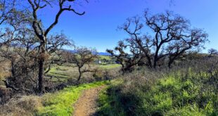

Mission Peak gets throngs of hikers but only a few trekkers take this route to the summit — an eight-mile out-and-back that stretches out the 2,000-foot ascent to the summit (the most-popular route ascends a similar height in a 5.2-mile out-and-back).
It starts from the parking lot at Ohlone College along Mission Boulevard in Fremont, California. Just one trail — the aptly named Peak Trail — curves and climbs its way to the 2,517-foot summit of Mission Peak. (From the parking lot, look for a sign pointing to Ohlone Trail).
Abundant parking at Ohlone College on the weekend makes this trailhead a welcome alternative to the Stanford Avenue entrance, which fills quickly and forces hikers to park on side streets where car break-ins have been common over the years.
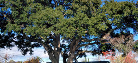
There’s also a bit more shade on this route compared to other trails to the summit.
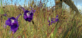
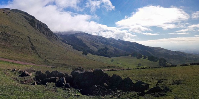
Impressive views of the Diablo Range and San Francisco Bay open up on the way up. Don’t be surprised if you see deer and coyotes the ground and raptors and vultures soaring overhead.
Best time to go: Springtime when the hills are green and the wildflowers are blooming. Winter’s the next-best time, especially if the peak gets a dusting of snow. Fall is OK; summer’s too hot during the day, but many hikers hit the summit at sunset and hike down after dark (best done under a full moon).
Tips: While this route is more gradual than other alternatives, it’s still strenuous with over 2,000 feet of elevation gain. It’ll be a major struggle for beginners. Bring enough water and snacks to sustain your energy level.
Use plenty of sunscreen, and dress for weather that can shift rapidly over the course of a day. Gale-force winds often pound the peak, so at least one wind-proof layer is worth taking along.
Cattle often graze throughout Mission Peak Regional Preserve — give them plenty of space and don’t come between mothers and their calves, or you could get charged.
Contact: (888) 327-2757, option 3, extension 4545
Parking fee: $2 (pay at kiosk in the college parking lot).
Hours: 7 a.m. to dusk
Driving directions: From I-880, take the northern Mission Boulevard exit (Exit 16) and turn southeast on Mission Boulevard, continuing for three-quarters of a mile; turn into the college; buy parking pass from vending machine in Lot B; park in lots M, N, O or P.
Visit the excellent website EveryTrail for more info and maps